


|
|
DMZ - Demilitarized Zone
WHAT IS DMZ | HOW TO GET THERE | MILITARY DEMARCATION LINE | PANMUNJOM | JOINT SECURITY AREA | BLUE HOUSES | CONCRETE WALL | ATTRACTIONS | AROUND DMZ
What is DMZ
The Korean Demilitarized Zone (DMZ) is a strip of land running across the Korean Peninsula that serves as a buffer zone between North and South Korea. The DMZ is a de facto border barrier, which runs in the vicinity of the 38th parallel north — which divides the Korean Peninsula roughly in half. The 38th parallel was the original boundary between the United States and Soviet Union administration areas of Korea at the end of World War II. Upon the creation of the Democratic People's Republic of Korea (DPRK) and the Republic of Korea (ROK) in 1948, it became a de facto international border and one of the most tense fronts in the Cold War.
NOTE: The border between North and South Korea is closed, meaning that nobody can cross the border between the two Koreas: there is no way to travel directly from South Korea to the DPR Korea, or the other way around. To travel between the Koreas, one needs to transfer through a third country first, such as China or Russia. The only place where it is possible to make a couple of steps into the opposite side is in the T1-T3 conference rooms, also known as blue houses—tent-like one-story buildings sitting just at the demarcation line.
DMZ is 250 kilometres (160 miles) long, approximately 4 km (2.5 miles) wide. The truce that ended hostilities was signed here in 1953, but as peace was never agreed to, the two sides are still officially at war over sixty years. There are no troops in the DMZ itself (except in the JSA), although both sides of the 4-kilometer strip of land separating the Koreas are the most heavily armed in the world.
How to get to DMZ
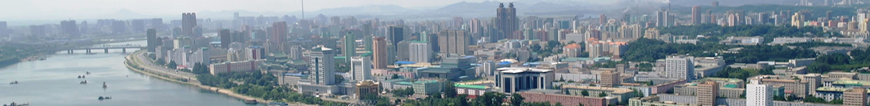
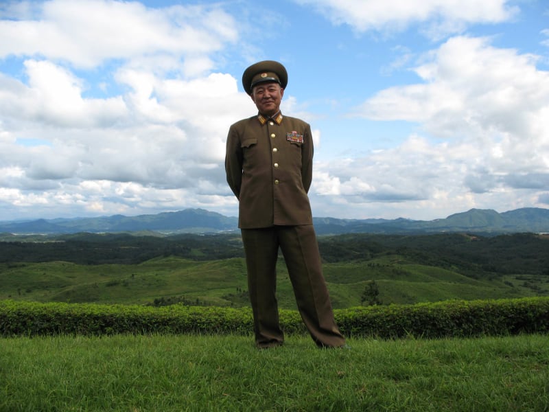
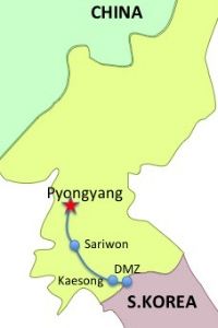
The DMZ is situated at the border with South Korea, 160 km along the Pyongyang-Kaesong Motorway southeast from Pyongyang. It is about a 3-hour drive from Pyongyang. On the way to the DMZ, you can make a stop at the Sohung Tea House that bridges the road, where you can have some tea, ginseng, and beer, and taste some local snacks. Virtually all group tours include the DMZ as a half-day adventure. Access to the DMZ is occasionally curtailed at short notice when tensions rise, most recently in May 2010 in the aftermath of the Cheonan incident.


Military Demarcation Line (MDL)
Military Demarcation Line is the actual border between North and South Korea. The DMZ is a buffer zone extending 2 km into North Korea and 2 km into South Korea along the north and south sides of the MDL.
Panmunjom
Panmunjom originally was a village between Kaesong and Seoul, now it is an abandoned village on the de facto border between North and South Korea. The village is 53 kilometers north-northwest of Seoul and 8 kilometers east of Kaesong. It became widely known after the Korean War as the place where the Armistice Talks that paused the Korean War were held between the DPR Korea and the USA in 1953. You can visit the Peace Museum—the meeting hall where the Armistice Talks were held, and the hall where the Armistice Agreement was signed.
After the Armistice Agreement was signed, a decision was made to construct the Joint Security Area (JSA) on a new site located approximately one kilometer east of the village. Construction began in September 1953, and all meetings between North Korea and the United Nations Command or South Korea have taken place here since its completion.
After the war, when all civilians were removed from the DMZ (except for two villages near the JSA on opposite sides of the Military Demarcation Line), the empty village of Panmunjom eventually disappeared from the landscape. There is no evidence of it today.


Joint Security Area (JSA)
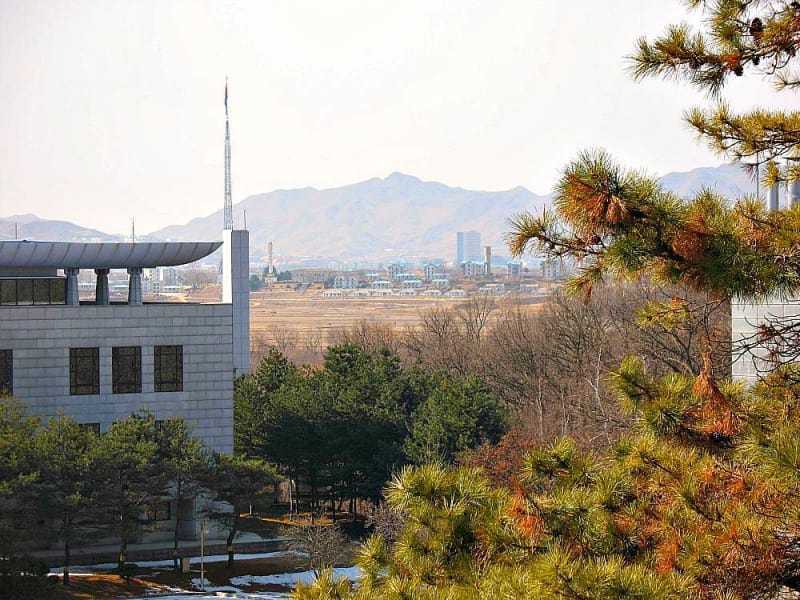
Inside the DMZ, one kilometer east of the Panmunjom village, is the Joint Security Area (JSA), an almost circular patch of land with an 800-meter diameter. The area is jointly policed by the South and North, and the two sides occasionally meet for discussions (or gunshots). Most of the time, the soldiers glare at each other across the border and have not been allowed to cross the demarcation line into each other's side since the Axe Murder Incident. On August 18, 1976, a US attempt to cut down a poplar tree obstructing the visibility of a bridge led to a battle with North Korean forces that left Capt. Arthur Bonifas and Lt. Mark Barrett dead in what was later known as the Axe Murder Incident. The bridge is now closed, and a new bridge to the north is used instead. The JSA is usually visited from the South only.
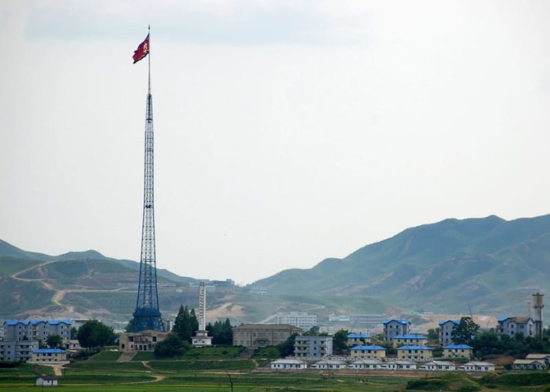
At various points along the road to the JSA, two huge flag towers can be seen—one in the DPRK, the other in the ROK. The 160m DPRK flagpole is located in Kijong-dong village and features a 270kg flag (size: 30m x 60m) of the DPRK. It is the third tallest flagpole worldwide; until recently, it used to be the tallest, but two former Soviet republics, Tajikistan (165m) and Azerbaijan (162m), have outdone the DPRK. There is a story that North Korea built its mast to outdo the ROK's 98m tall flagpole located in Taesong-dong village.
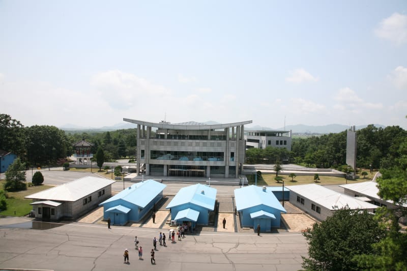

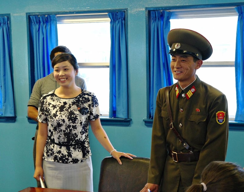
Central Conference Room T1 -T3 / Blue Houses
One of the main attractions in Panmunjom is a visit to the blue, one-story tent-like building where officials from the two Koreas meet occasionally. A conference table covered with green velvet is placed directly over the border line, and the microphone cable that runs down the middle of the table is officially recognized as the international border. When tourists are ushered into the building, soldiers stand at either end of the building guarding the day-trippers. You're free to walk around the conference room and can hop from South to North if you wish. Just don't try to leave by the other exit!


Concrete Wall
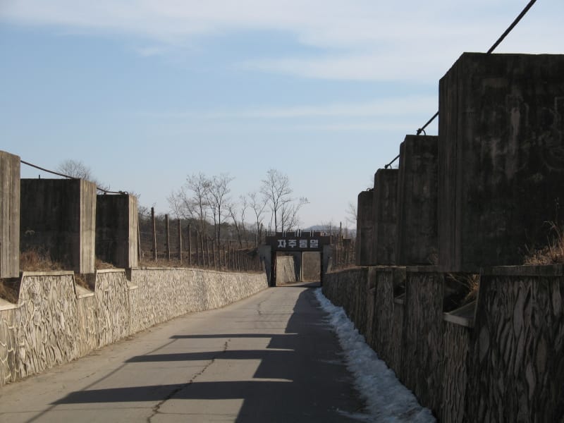
In the area south of the Military Demarcation Line, which cuts across Korea at its waist, there is a concrete wall that stretches more than 240 km (149 mi) from east to west. The wall is 5–8 m (16–26 ft) high, 10–19 m (33–62 ft) thick at the bottom, and 3–7 m (10–23 ft) wide at the top. The wall was built from 1976 to 1979 by US forces along nearly all of the DMZ. It is set with wire entanglements and dotted with gun embrasures, lookouts, and various military establishments.

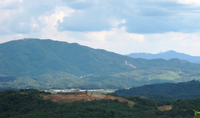
East of Kaesong's Nam Gate is a good viewpoint for this impressive wall
Main Attractions
- Panmunjom village - It became widely known after the Korean War as the place where the 1953 Armistice Talks, which paused the Korean War, were held between the DPRK and the USA.
- Panmungak - palace facing the demarcation line
- Monument to Autograph - it is dedicated to the handwriting of President Kim Il Sung, who examined and signed a document related to national reunification the day before he passed away
- Concrete Wall - An 8-meter high concrete structure, known as the Wall of Division, built by US forces along nearly the entire DMZ from 1976 to 1979.
- T1 through T3 blue houses - These are the conference rooms straddling the border. Inside, the neat lines of microphones and outside, the low concrete bar mark the exact position of the line of demarcation. Both South and North Korean soldiers stand guard in intentionally intimidating poses in and around the rooms. You're free to walk around the conference room and can hop from South to North if you wish. Just don't try to leave by the other exit!
- Bridge of No Return - After the Korean War, some prisoners of war were given the choice to cross over the bridge or stay on the side of their captors, hence the name. On August 18, 1976, a U.S. attempt to cut down a poplar tree obstructing visibility of the bridge led to a confrontation with North Korean forces, resulting in the deaths of Capt. Arthur Bonifas and Lt. Mark Barrett in what became known as the Axe Murder Incident. The bridge is now closed, and a new bridge to the north is used instead. It is usually visited from the South only.
- Peace Museum - The building where the armistice agreement was signed. The actual documents are kept here, along with the axe from the Axe Murder Incident.
- Kijong-dong - This is a former village built up with fancy apartment blocks and a 160-meter flagpole, which entered the Guinness Book of World Records as the world's tallest. Entry into the village is not permitted, but it is clearly visible from the JSA
- Kaesong Industrial Zone. Increasingly well-known for the Kaesong Industrial Complex, a 'special economic zone,' developed by Hyundai Asan with North Korea. In 2012, this special administrative industrial region had over 50,000 North Korean workers, typically working for about 20% of the South Korean minimum wage in dozens of brand-new factories operated by more than 100 different South Korean companies. In April 2013, North Korea recalled all 53,000 North Korean workers from the Kaesong Industrial Complex, effectively suspending all operations. In response, South Korea withdrew all of its citizens working in Kaesong and threatened to abandon the venture. In October 2013, there were small yet positive steps by both sides to resolve the issues and eventually resume operations.
|
Around DMZ
- Ryongthong Temple - It is famous as the holy place of the Korean Chonthae Sect of Buddhism, nestled in the Ryongthong Valley of Mt. Ogwan
- Kaesong - Kaesong is a small city at the border with South Korea, located only 8 km from the DMZ. It was the former capital of the Koryo Dynasty (918–1392 CE) for several hundred years and was the only major city that changed hands between North and South Korea as a result of the Korean War
- Sariwon - Sariwon is a city situated halfway along the Pyongyang-Kaesong Motorway, making it an ideal stop for a halfway tour. Sariwon is the capital of North Hwanghae Province and serves as the southern gateway to Pyongyang. With a population well above 300,000, Sariwon is one of the most densely populated cities in the DPRK.
The materials from wikipedia.org, visitkorea.or.kr were used at this page